
Danforth Brook Bridge Reopens
Freedom—January 24, 2021—I’ve visited the site of the new Danforth River Bridge over the past few months to capture the progress being made on the project. The following shots were taken on November 7, 2020:
Photo 1: This is the work site from the downstream side of the bridge, looking north on Ossipee Lake Road. We see the new partial North Abutment and sheet piles, driven to facilitate the excavation, forming and pouring concrete for the footing and abutment for new bridge.
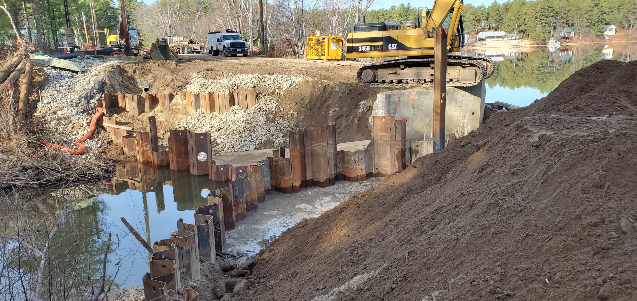
Photo 2: This shot was taken from the upstream side of the North Abutment.
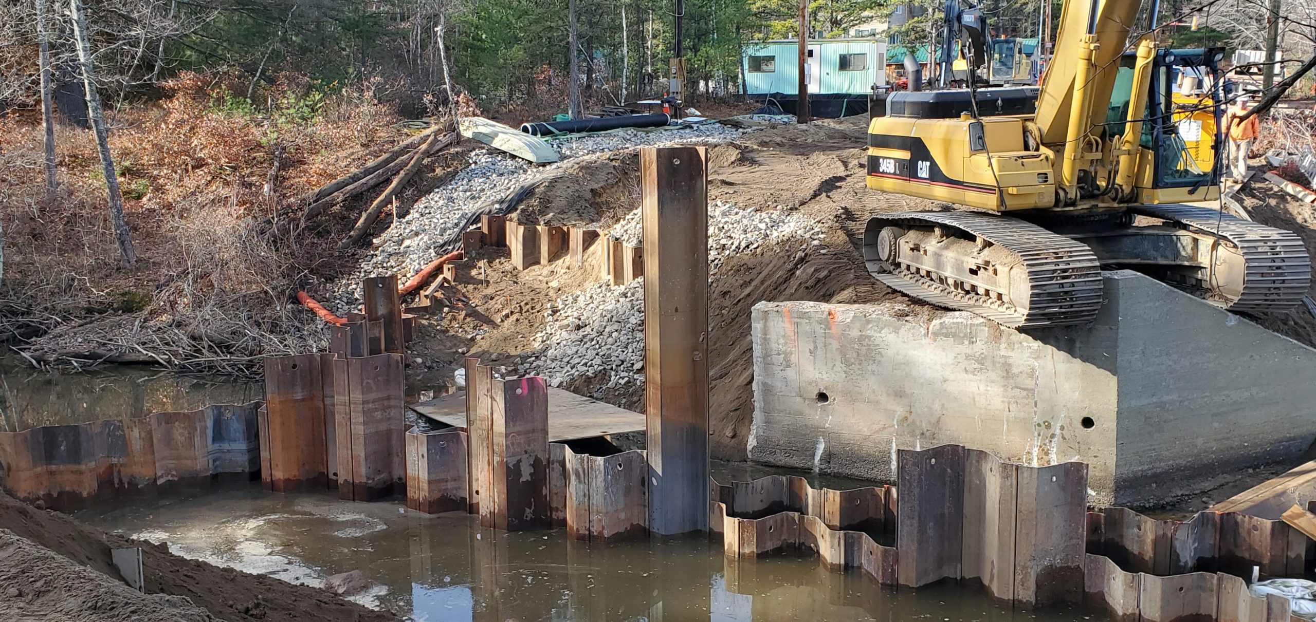
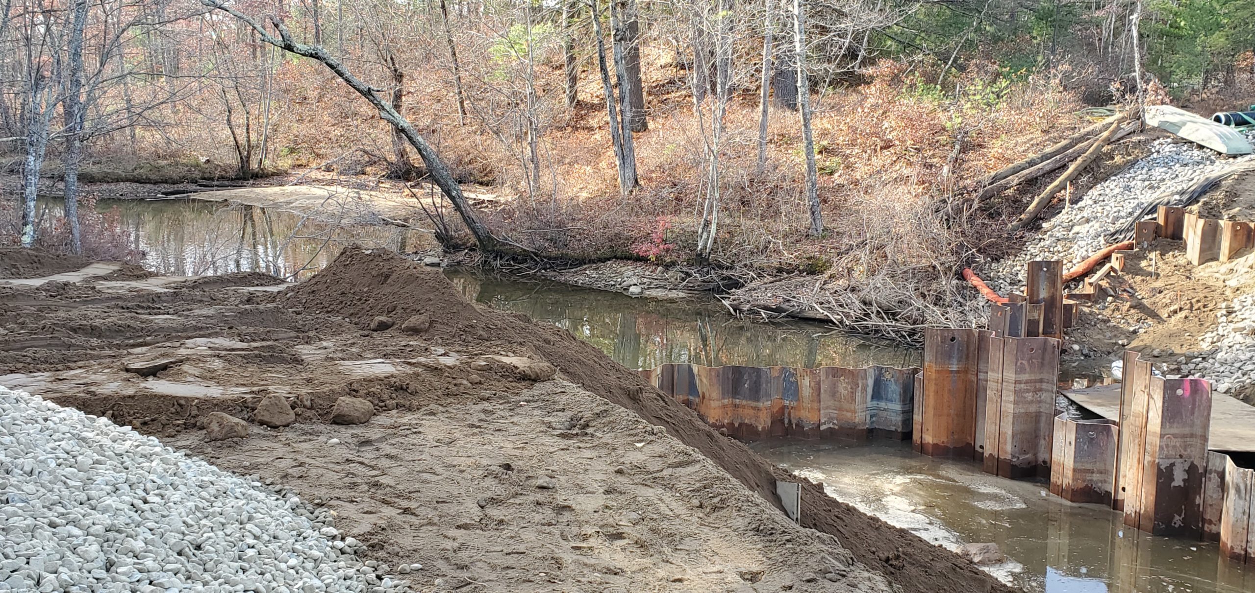
Photo 3: Looking downstream onto Danforth Brook.
The following shots were taken on January 22, 2021 and show quite a bit of progress.
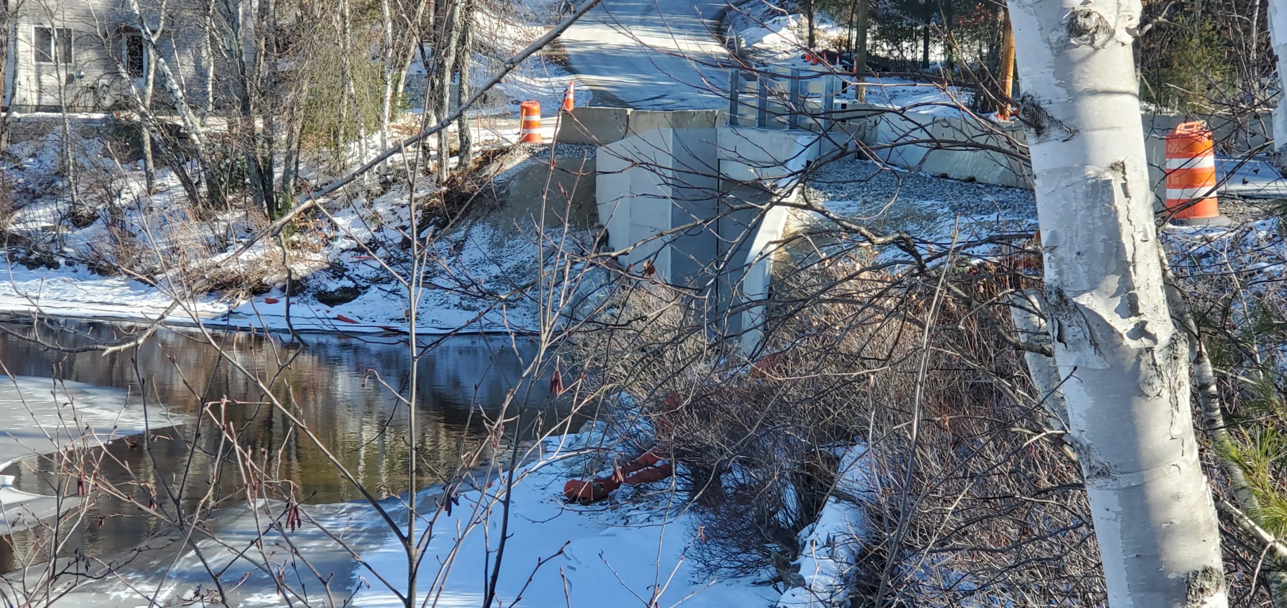
Photo 4: This is on Danforth Brook, looking upstream toward Lower Danforth Pond. The abutments and wing walls and bridge deck concrete work are complete, and the road is open to traffic in both directions. The portal under the bridge deck is slightly wider and slightly taller than previous clearances. Perhaps now boaters may be able to pass through without lowering their Bimini top!
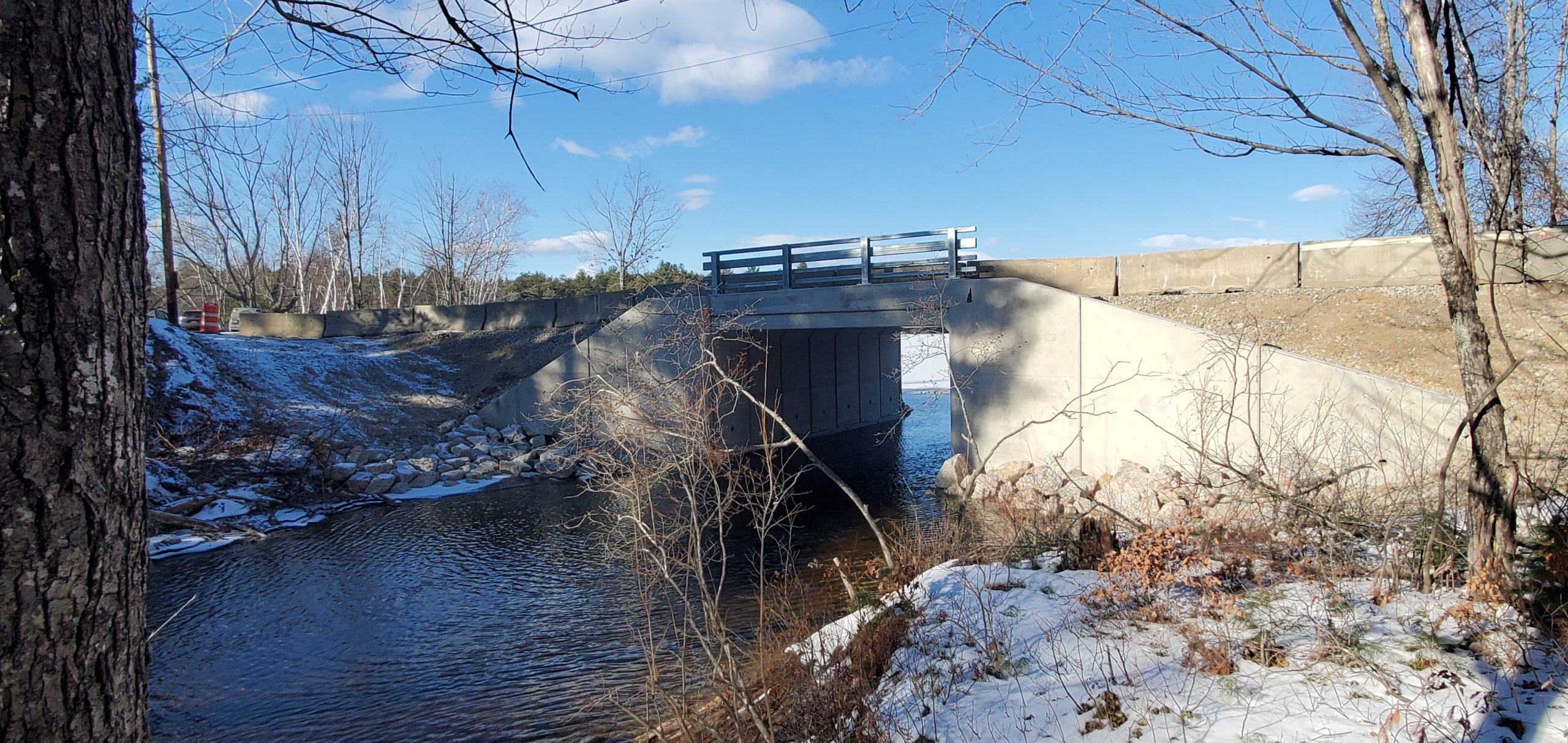
Photo 5: This shot shows the north face of bridge and wing walls. The concrete work is complete, and there is erosion control ballast (stones) on each side of the portal to protect the concrete wing walls and abutments from erosion and undermining. This ballast will also keep “overly zealous” boaters from driving into the wing walls, as well as help direct the water flow through the portal and under the bridge. Note the ice fishing gear in the right rear of the shot. There were more than 25 people ice fishing on Lower Danforth during my visit. Hopefully they were catching more than cold!
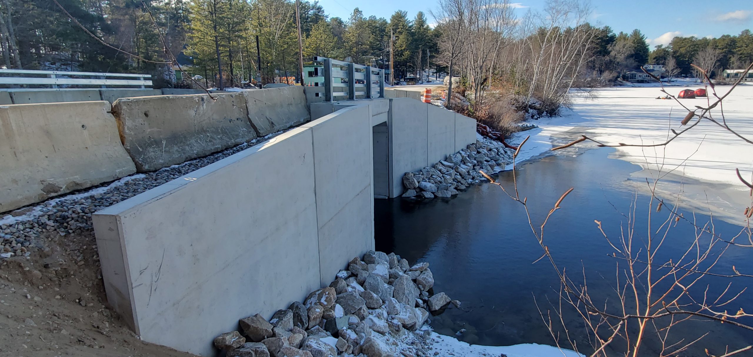
Photo 6: A view of the north face of the bridge facing south on Ossipee Lake Road. As you can see, the bridge replacement has had a minimal impact on the natural terrain and vegetation. Even the disturbed stream bed was remediated to provide a near-natural surface that can reduce potential erosion during high water spring runoff and storms like the tail-end of Superstorm Sandy in 2012.
I’m acutely aware of the force and impact of hurricanes, as I’ve lived through numerous severe storms, including 1954’s Hurricane Carol, and two follow-on storms, Hazel and Edna, which fortunately veered east at the RI and MA coast, sparing the North Shore of Oneida Lake, where my family was living at the time.
Here in our area, Hurricane Carol washed out the old Route 16 bridge over the Bearcamp River, leaving only the concrete abutments. Those abutments remain, flanking the river on Grizzley Road, which is now a private way on private property, and on Newman Drew Road, both in West Ossipee (formerly Ossipee Valley).
When I visited the new bridge last week, Lower Danforth Pond was frozen over except for the area extending approximately 30 feet north of the bridge portal. Danforth Brook was open, flowing slowly into Broad Bay adjacent to Ossipee Lake Marina.
Comments (2)
Comments are closed.
Thanks for the photos and documentation. It will be interesting to know the final cost of this job.
Thanks for the photos. I have a photo of my parents on the bridge from about 1938. As a boy 7 to 14, I would paddle between Broad and Danforth during the family summer vacation.