
A Final Look at the New Dam
Freedom—January 17, 2021—I visited the dam last week to take some final photographs of the project. I had hoped to photograph the gate operation, but unfortunately I was not contacted, and the contractor has left the site and the project is effectively completed. The current photos of the new dam follow:
Photo 1: This is a view of the upstream side of the new dam, at the lower end of Berry Bay, with our lake waters now flowing through. The vertical steel beams provide the supports for placing (lowering) the wooden drop blocks, when gate service or maintenance is required or necessary. Conceptually, the new design replicates the design of the drop blocks in the old dam, which was removed during the dam replacement project.
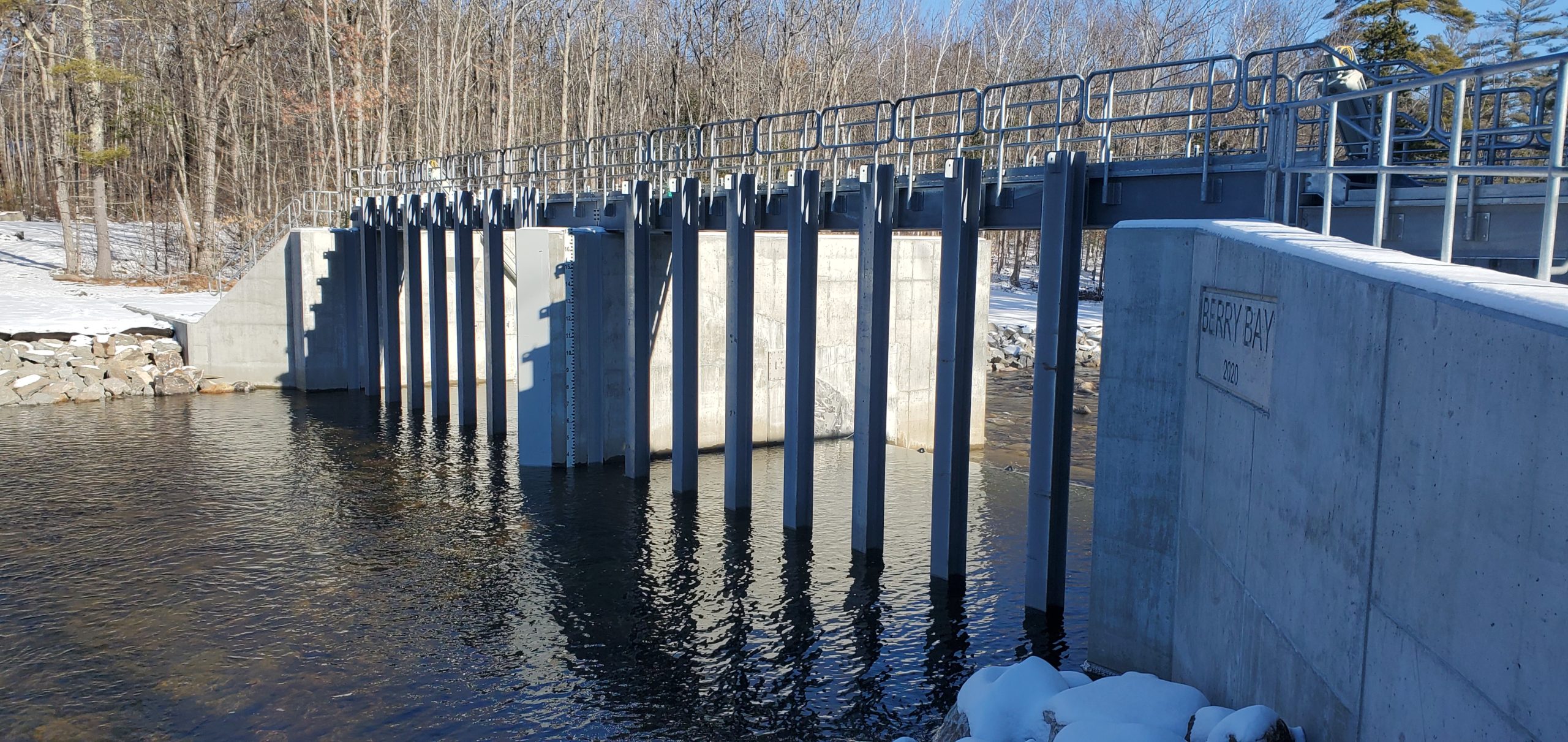
Photo 2: This shows the stone ballast upstream from the dam, located at the actual site of the original dam. The water is gently flowing out of the lake toward the ocean. The lake bed restoration looks very natural, and awaits the rising waters of the spring.
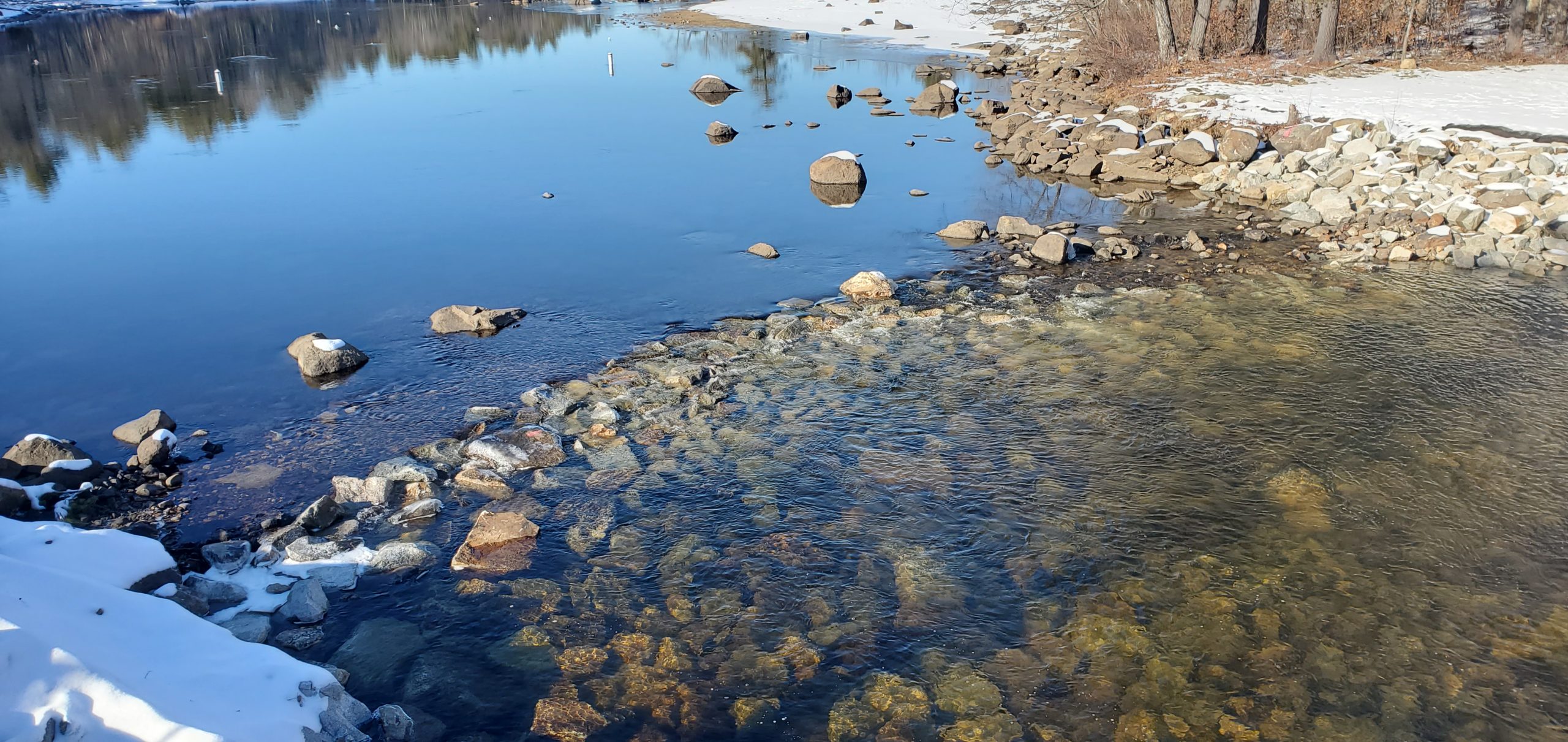
Photo 3: Looking across the catwalk atop the new dam. The two hydraulically-operated gates are currently in the low, or down, position, and water is slowly flowing over them.
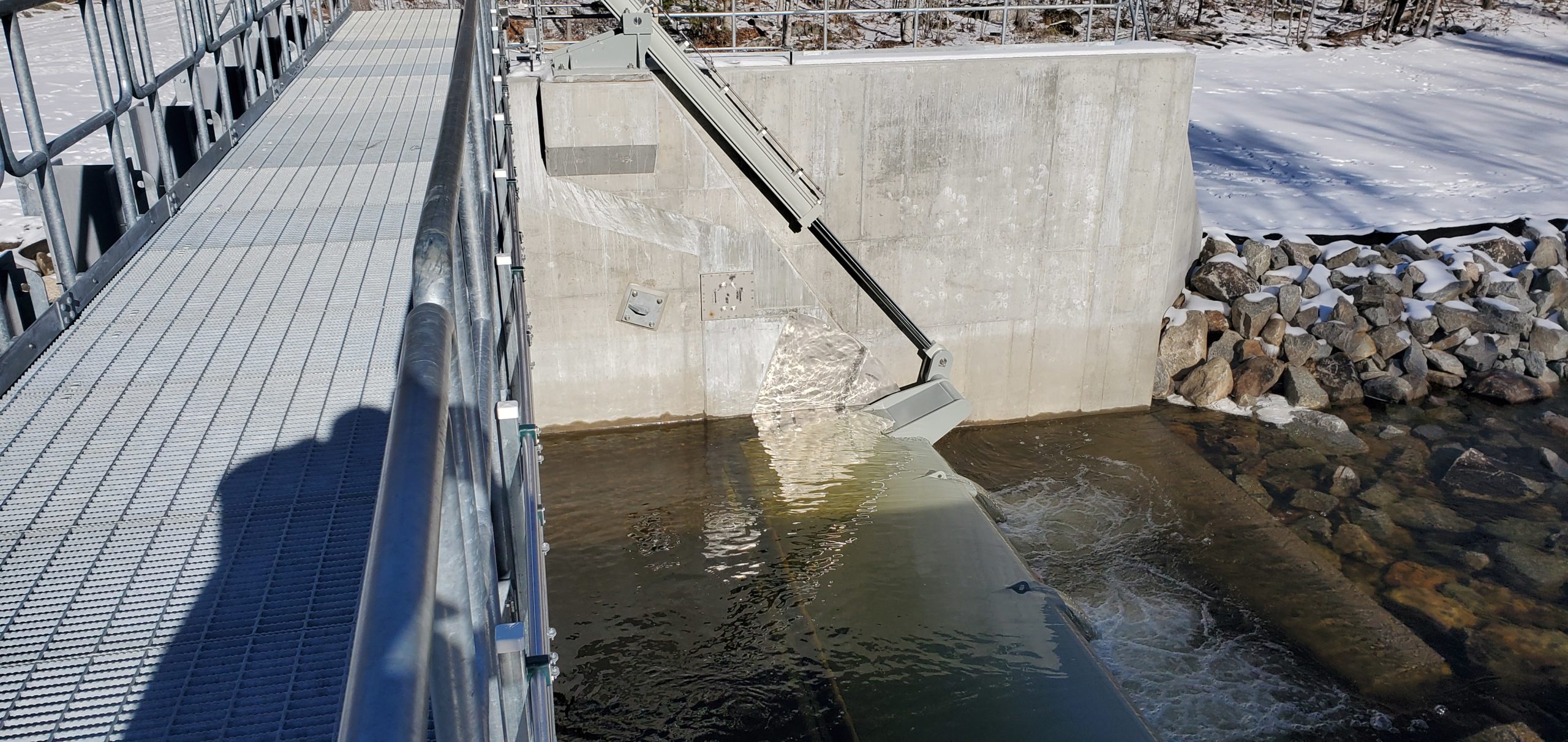
Photo 4: This shows the outfall, looking downstream from the new dam. The reconstructed riverbed currently has a small amount of water flowing over it and headed for Maine. That will certainly change a bit when the spring snowmelt occurs!
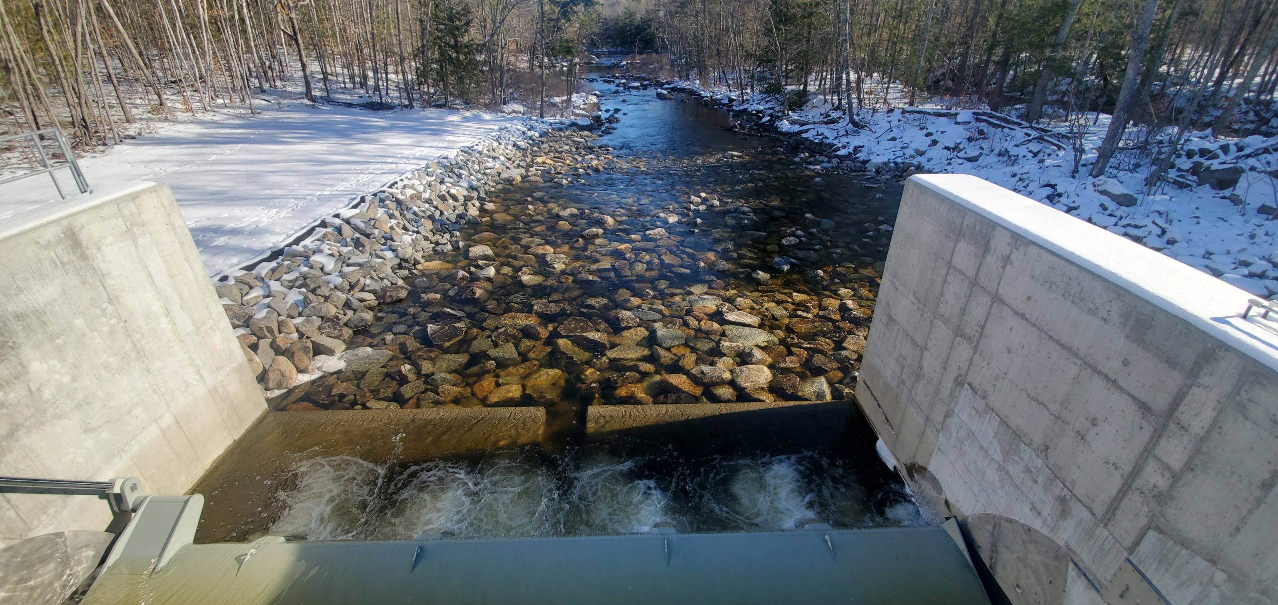
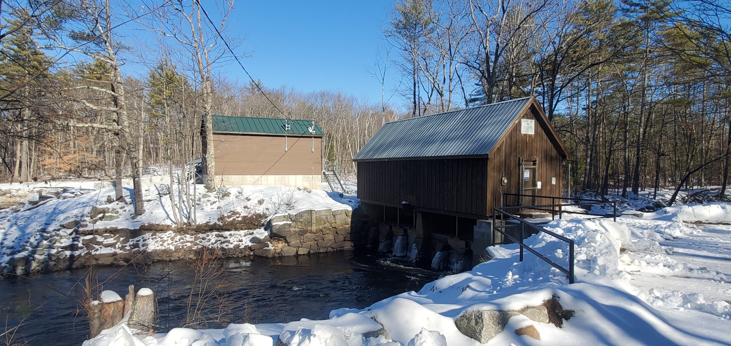
Photo 5: The catwalk across the top of the new dam, with the new headhouse at the far end. The emergency generator and the hydraulic equipment are housed in the headhouse, as well as the drop blocks which can be lowered into the steel beams when gate maintenance and service are required. This catwalk is now accessible from the stairs rising up from the “peninsula,” which is situated between the two headhouses and extends some distance downstream.
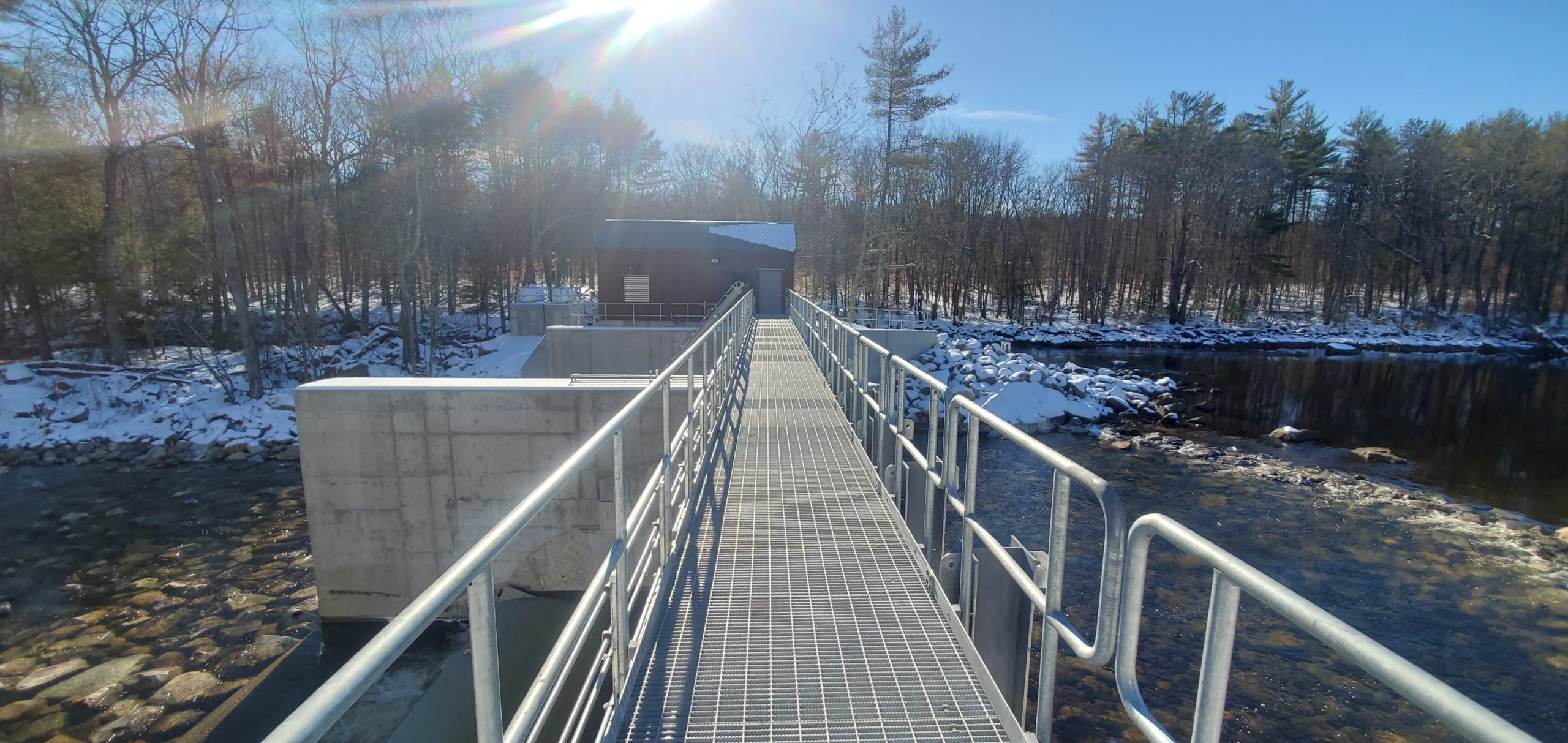
Photo 6: This close-up shows the hydraulic actuator for one of the two gates. When activated in the spring, the gates may be raised to detain the water, ultimately bringing the lake water level up to Elevation 407.25 ft. The drop gates beneath the older headhouse will also be raised or lowered to maintain the lake water level.
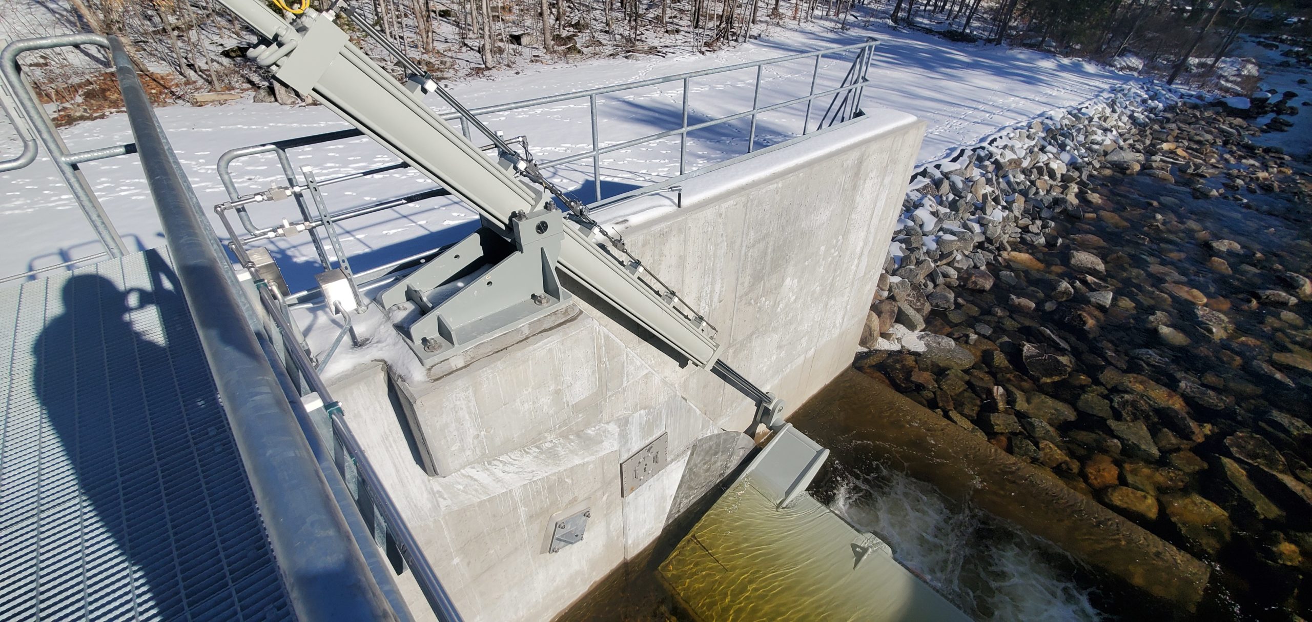
Photo 7: View of the grassy area (under the snow) between the old headhouse and the new one. Between the two headhouses, in the distance, the propane tank platform can be seen. The propane provides fuel for the emergency generator.
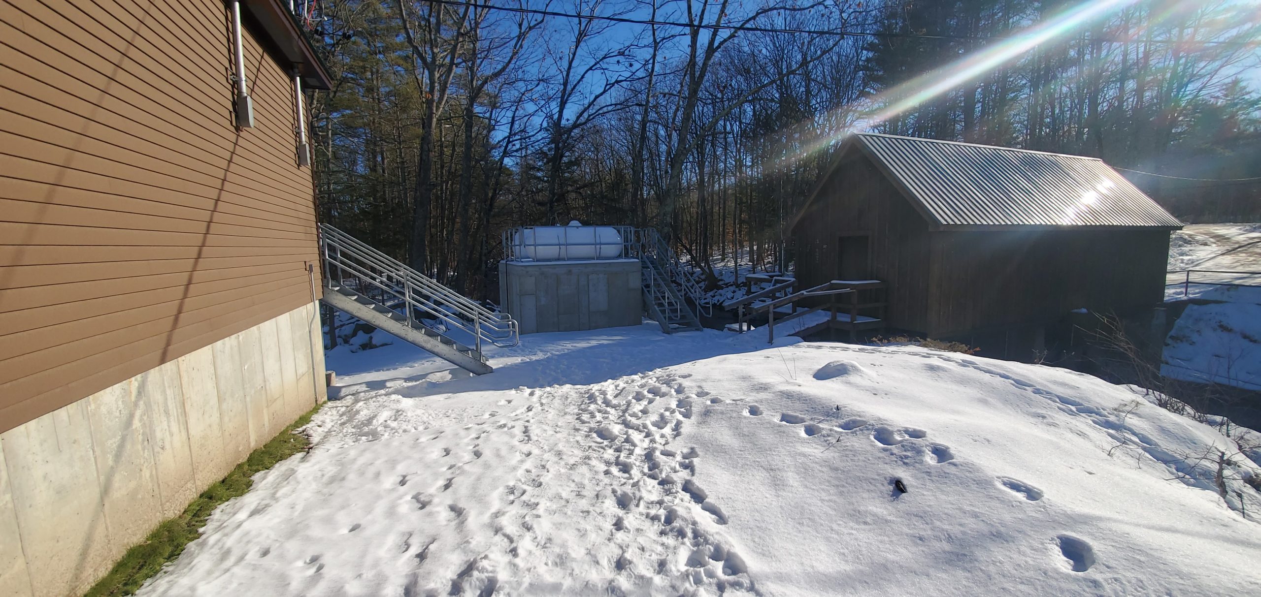
Photo 8: Another view looking downstream from the new dam. When looking down at the lowered gate in this bay I noticed a fish swimming in the shallow waters flowing over the lowered gate. Unfortunately it was not very photogenic, and swam out of view before I could take a photo of it. The overall appearance of the riverbed reflects the great job the Charter Construction Co. crew performed in restoring the terrain that was disturbed during the construction of the dam.
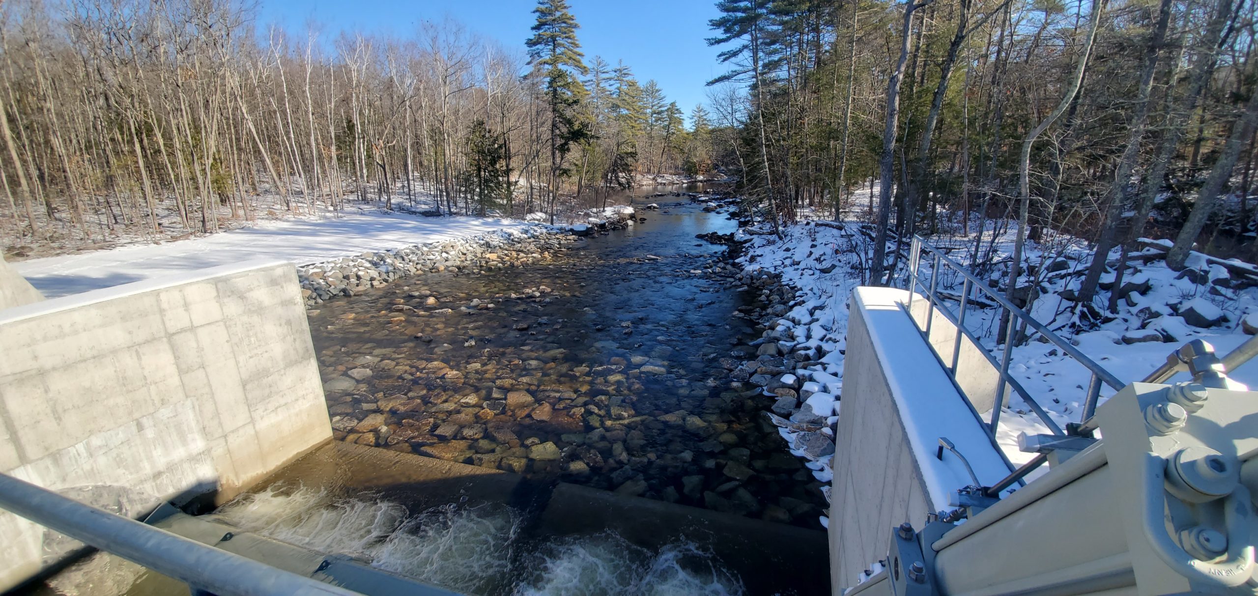
Photo 9: The two headhouses at our dam. The bulk of the outflow of water from the lake is currently flowing through the open gates under the older headhouse. The finishes on the new headhouse blend nicely with the surrounding landscape, and its presence creates a low visual impact on the overall site.
As winter wanes and spring arrives, it will be interesting to view the raised gates as they retain the lake and bay waters, once again providing the watery playground for our summer enjoyment!
Comments (11)
Comments are closed.
Thank you and we appreciate the compliment on our work at the dam. We enjoyed building this project for everyone involved.
Steve
Project Superintendent
Thanks again great pictures and story.
Thanks for the great reporting on this important project.
Great job. Thank you for your hard work during all the seasons, and weather conditions.
Really nice photos (in past) and now. Keep up the good work.
Thanks for the great photos.
Thank you so much, Tim, for all the great pictures and explanations. The dam should be around for a LONG, long time.
How come that there are no fish ladders ??
With planning with the state of art how come no water power generators ? just a thought , but would like a answer thanks John
I had asked this question before but never got a answer
Accolades to both Steve and Nick, as well as the entire project team (Charter Construction Co. and All the SubContractors), for their expertise, perseverance and determination in seeing this project through to completion, especially during the less than ideal conditions: rains, high waters, winter, etc.!
John, this is from the state: From October through May each year, which includes the time of the year that fish are expected to be migrating, the gates will be in the lowered position and should not pose an obstacle to fish migration. In addition, from May through October, when the gates will generally be in the raised position, a gate in the gatehouse will generally be open to allow for downstream migration.
Regarding the potential for hydropower at the site, NHDES currently leases out nine of its dams across the state to hydropower developers who have constructed and now operate hydropower stations at the sites. These developments occurred in in the 1980’s. Since then, from time to time, we have received inquiries from potential developers for other suitable sites, and we have provided them pertinent information on all our dams, including the dams at Ossipee Lake. However, these inquiries have never led to proposals for hydropower development at any of our undeveloped sites. At Ossipee, the low head, which is the difference in height of the water above and below the dam, is too small to make the development economically feasible given the cost for development and operation and the relatively low price that hydropower operators currently receive for the power they generate.
New to the area so curious….how does the lake level effect the flow to Parsonsfield, Me.? Does it flow on a schedule or intermittently?
Thank you