
There’s More to Headway Speed Than the Channels
Freedom—July 3, 2023—With the boating season underway, and with so many new boaters on the lake, it’s a good time for a refresher on headway speed.
Headway speed is the slowest speed at which it is still possible to maintain steering, or six miles per hour. State law mandates slowing to headway speed when closer than 150 feet to other boats, rafts, swim areas, docks, and the shoreline.
Most boaters are familiar with headway speed because of the channels that connect the bays and connect to the big lake. Upon exiting one of those slow lanes, also known as no-wake zones, it’s easy to forget that headway speed can also be required in open water.
To make it simpler to picture what 150-feet looks like, we partnered with Green Mountain Conservation Group and used GIS data to create maps illustrating the headway speed zones around the lake.
Consider Berry Bay. The smallest of the lake’s bodies of water, it has seen the number of boats increase in recent years just like the rest of the lake. That can present safety issues on crowded weekends, as illustrated by the Berry Bay headway speed map.
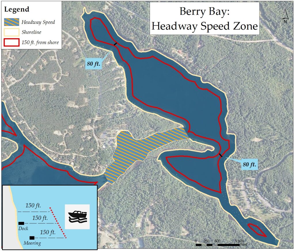
The red line marks 150 feet from the shoreline around the bay. Outside the line is headway speed at all times. Inside the line is the area of safe operation, where boaters can operate at speed. The interior area is approximately 450 feet wide.
Even in the area of safe operation, it is likely that you will have to reduce to headway speed during busy times if you encounter two or more boats, as it may be impossible to keep to the legal distance because of the bay’s narrowness.
Even narrower are the areas shown in the north and south of the bay, where the area of safe operation closes to just 80 feet. You can operate at speed in those areas as long as there are no other watercraft. Otherwise, headway speed is required.
Roberta MacCarthy, who heads Berry Bay Association, says complaints about violations of the 150-foot rule have spiked in recent years, especially in regard to wake boats.
To avoid having to slow or stop when boat traffic is heavy at the center of the bay, wake boat operators sometimes operate outside the red line, creating a double danger by being too close to shore and creating huge waves that erode the shoreline and have been known to knock down swimmers.
“Given the narrowness of the bay, there isn’t enough time for the oversized wakes to dissipate,” MacCarthy says.
Our illustrations of the areas of safe operation were calculated with GIS data using the shoreline as the benchmark. But the reality is that boaters need to stay 150 feet away from docks and moorings to operate at speed, and that further reduces the size of the center cone.
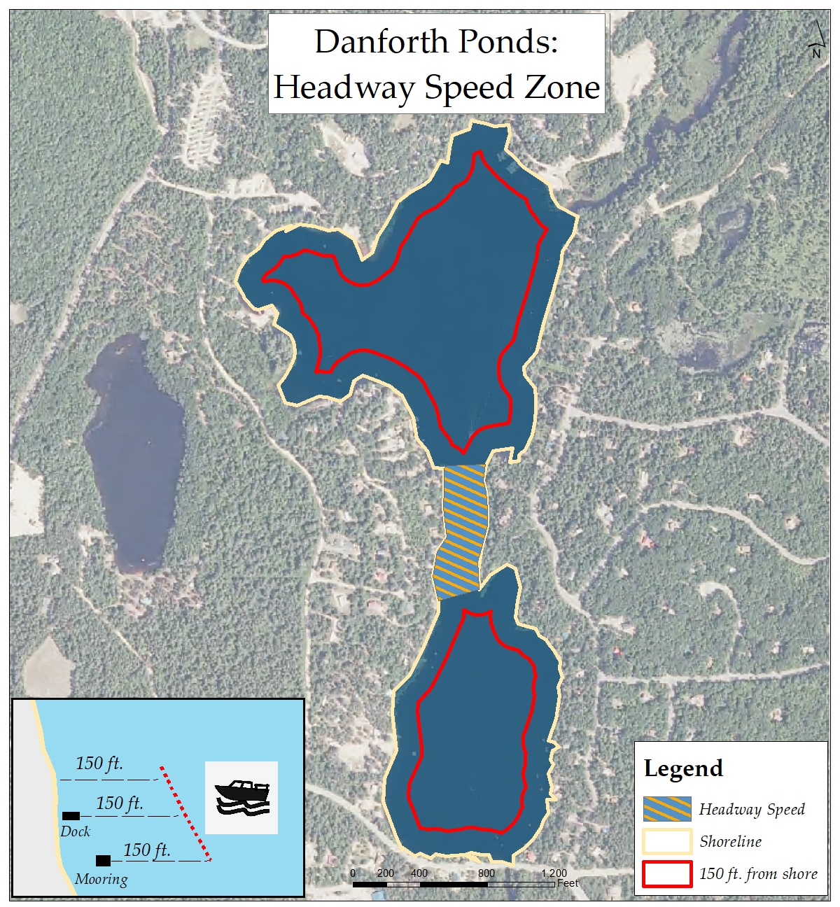
Danforth Pond also has a challenging boating situation, most notably in Lower Danforth. As with Berry Bay, when boat traffic is heavy it is likely you will have to slow to headway speed in open water when you encounter other watercraft.
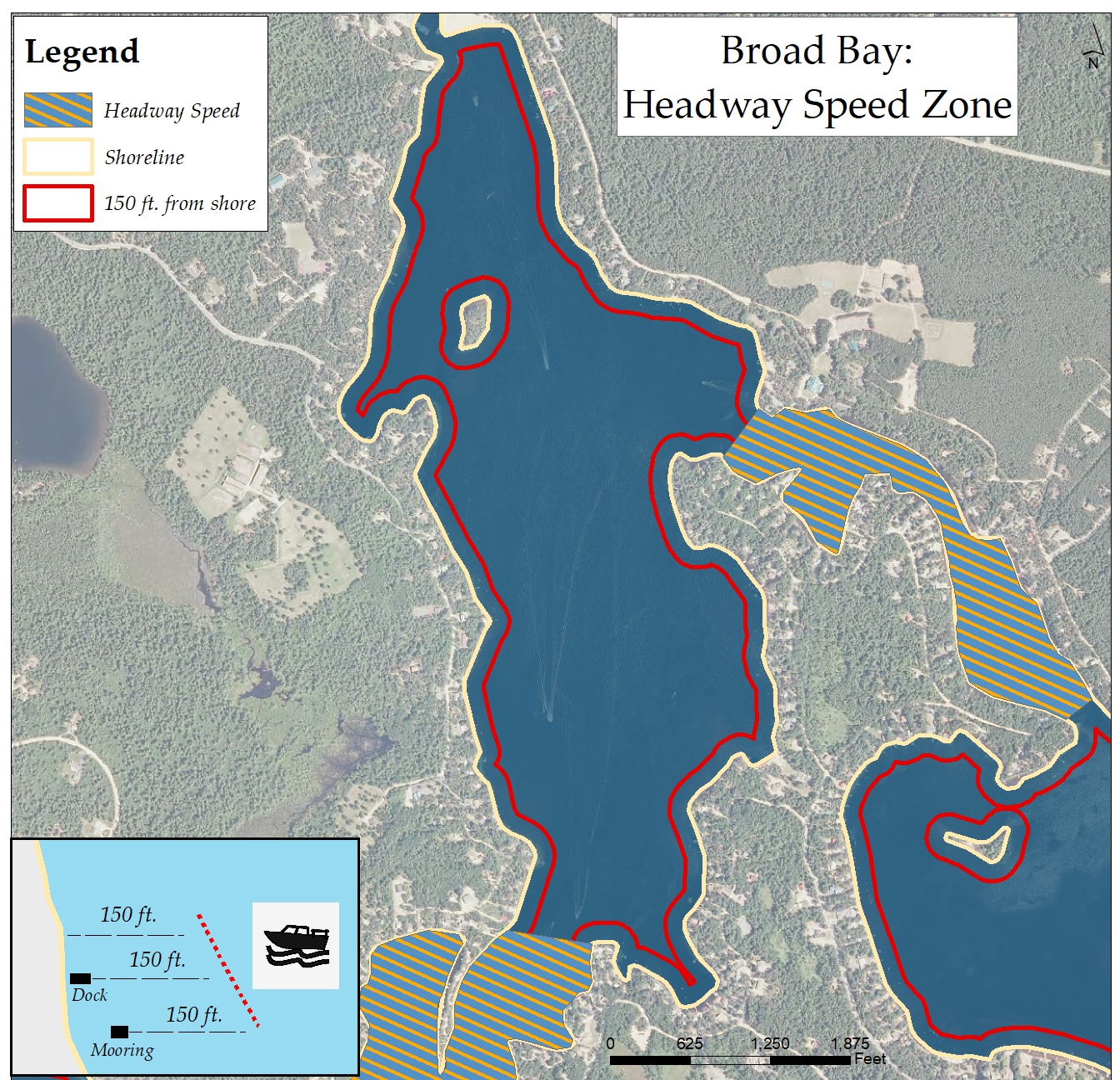
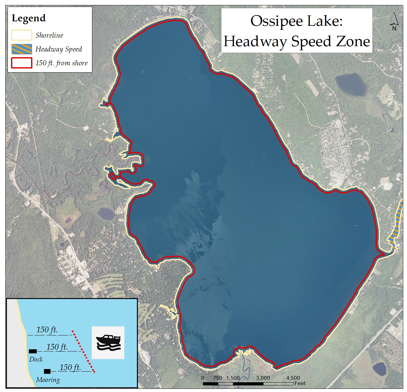
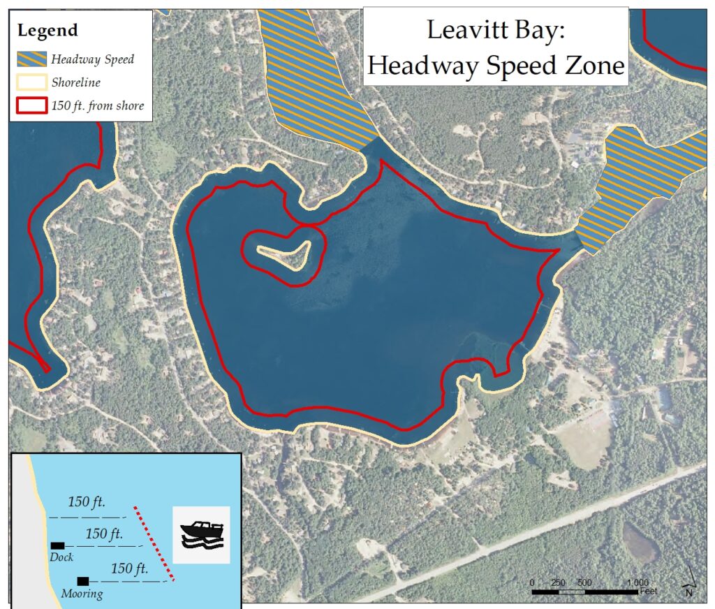 The situation is relatively straight forward on Leavitt Bay except between the island and the spit of land to its north, and the choke point around the buoys leading to the channel to Berry Bay. Broad Bay has a fairly wide cone of safe operation, but the big lake offers the widest area of all.
Operating too close to land or other boats, often because of distracted boating, is an important safety issue in the state, according to Marine Patrol’s Lt. Crystal McLain.
In an email to Ossipee Lake Alliance, McLain also pointed to boating while intoxicated (BUI) as a growing issue. The penalties for BUI mirror DWI penalties for drivers of cars and trucks, and can include fines and loss of both boating and driving privileges.
“Operators should maintain a consistent lookout all around them while navigating the lake,” she concluded, adding that Marine Patrol officers will be on the lake all summer.
Editor’s Note: Safe boating on Ossipee Lake also requires knowledge of the lake’s depth, which varies widely across the lake system. You can access this information on our Bathymetric Maps page at this link.
Comments (4)
Comments are closed.
Great article well worth the read.
Thank you. Shoreline erosion is becoming very noticeable on Leavitt Bay.
Good reads here. Thank you. Pontoons and other (deep hull) vessels create erosion(s) too.
I Agree more boats than ever and the people running them is a problem, lots of violations out there